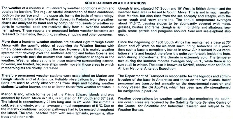
ZD9GG 1977 & 1978 Gough Island
I was active from Gough Island
from 5 November 1977 to 12 November 1978.
P.J. (Ean) Retief - ZS1PR (ex: ZD9GG / ZS6UD / ZR1CV)
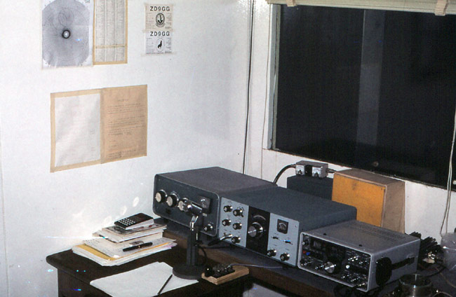
The HF station consists of a Heathkits HW-101 and SB-200. The box with the yellow cloth is a homebrew speaker-box for the HW101. The microphone is a Electro Voice model 638 (Heathkit HDP-21A). I still use the Electro Voice as I have been told many times that it suits my voice very well. I still use the same morse key today! To the left (in front of the SB200) you will see some books and a sceintific calculator (mainly used to calculate the next OSCAR 7 or 8 pass). You can see a Coverage map for the OSCARs on the wall. To the right is a Yaesu FT-220 multimode tranceiver used for the OSCARs. Just behind it you can see the heatsink fins of a Heathkit HA-202 amplifier that I modified slightly for SSB operation. The little SWR bridge is coupled in the antenna circuit after the HA-202. While Weather-sat signals have been received and relayed to South Africa for several years from Gough by that time, I was the first person to make a transmission via any satellite from Gough. It was the first amateur operation from the ZD9 via satellite and also the first transmissions via satellite of any kind from land in ZD9. There may have been a ship in the area with INMARSAT that made a Maritime Mobile transmission before my time, but quite unlikely as INMARSAT-equipped vessels was fairly rare back then.
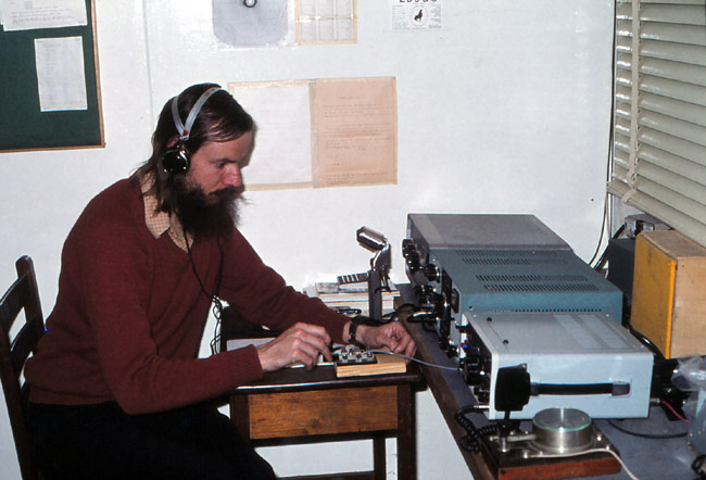
This is a younger version of me busy at the station. The large British Post Office Morse key to the right of me is coupled to the YAESU FT-220. It is tradition in the South African Antarctic and Islands programme NOT to have a haircut or shave while doing your stint.
At the time of my sojourn on the Island all contact with the “outside world” was via HF radio. The main antenna was a Rhombic of 300 m (nearly 1000 feet) in length and 25m (83 feet) above the ground. Leg lengths were about 200m (656 feet). This was the main transmitting antenna.
I used this antenna for transmitting and receiving and made about 85% of my contacts with it, ranging from 80 to 10 metres and initially mode-A receive on OSCAR 7 and 8. With it’s high gain, good height above the soggy wet ground and clear take-off over the sea it was a dream antenna and gave me almost all my contacts for DXCC number 21550.
While Gough Island falls under the South African “Antarctic and Islands” programme it is by no means a frozen icy place as many people believe. The base is situated at 40° 21’ South and the climate quite benign – During our period from September 1977 to November 1978 the minimum temperature recorded at the base was +1 °C (34 °F) with a maximum of 25 °C (77 °F). The annual rainfall is very high at 138 inches ( 3500 mm ) per annum.
The next photo shows the view when I looked up from the operating position through the window above the equipment.
Yes, the sea is indeed that deep near-black blue! The sea temperature we recorded ranged from 8 °C (46 °F) to 15 °C (59 °F). There is a lot of Rock Lobster around the island and angling from the rocks also yielded excellent fresh fish. The Island is a bird paradise with an estimation of some 20 million breeding there annually. Gough is considered to be one of the most unspoilt places on Earth.
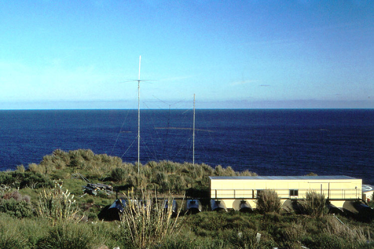
In the photograph above you can see the antennas mainly used for receiving, but I did use the Ground-plane (white antenna) on the left mast for 15 metres with excellent results especially into Western Europe. As you can see the “take off” over the sea is really good from the high and clear location.
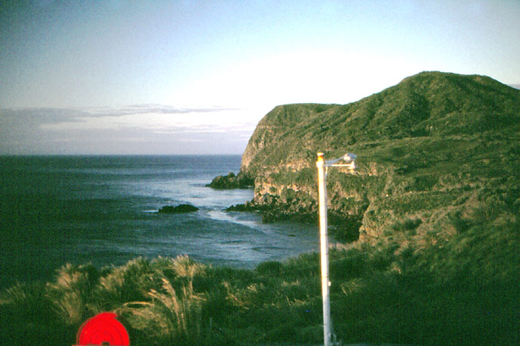
This view is looking Southward from another Radio-room window. Like many remote islands Gough (pronounced “Gof”) was discovered more than once. It was originally discovered by a Portuguese seafarer (Alvarez) in the early 1500’s and he placed it geographically some 200 miles from the present position. Captain Gough from Britain rediscovered the island in 1731 and for a time both Alvarez’s and Gough’s Islands appeared on Maps. The hill in the view above is called “Richmond hill” after the Gough’s ship.
In this photograph it can be seen that the cliffs on the Island’s edge are near vertical. This is the case along most of the shoreline. The few beaches are very rocky and the water goes very deep once one leaves the shoreline. The island is virtually a “peak” on the huge underwater mountain range called the mid-Atlantic ridge. The island is 5 miles wide (at it’s widest point) and 8 miles long. The surface area is 13 square miles with the highest peaks up to 2986 feet high (metric 8 x 13 kilometres with peaks up to 910 metres). The base is located on the only flat plain on the South-East of the Island, so as to have it “in the open” for weather, as it is mainly a meteorological station doing both surface and upper-air measurements and observations.
All my free time was not taken by Amateur radio. I walked a lot, combining my two other hobbies of photography and mountaineering.
I used a defunct 137 MHz quarter-wave Meteosat weather-satellite receiving antenna above the radio room as my OSCAR tranmit antenna. I also erected a Windom stretching low over the base and left it there as an additional receiving antenna when I left.
About five years later the Post Office in South Africa issued a series of stamps featuring the Weather Bureau and the 25c stamp was titled “Weather observation”. It showed a Meteorologist taking readings on the observation platform on the base roof at Gough. In the background is my old OSCAR transmit antenna (extreme right) while the Windom I erected can be seen behind him at hip height.
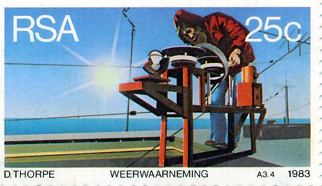
So therefore, I claim to be the only Radio-amateur with his antennas featured on a postage stamp.......................
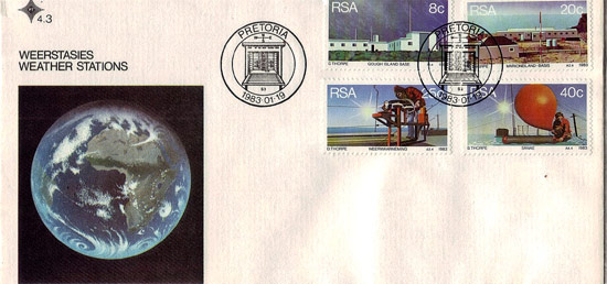
These two images (front and back) are of the "first day cover" envelope.
More “up to date”
information about Gough can be found on the following website:
http://www.sanap.ac.za/sanap_gough/sanap_gough.html
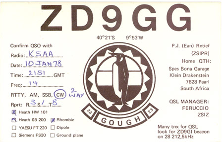
QSL from the estate of W9LF /
W9PKW / K1JTC / K5AA
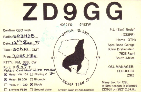
Info and photos courtesy of ZD9GG / ZS1PR